The platform offers full support for coordinate systems and Geodesy through IOGP EPSG CRS geodetic parameter dataset, all displayed in interactive maps. Convert and transform locations between different coordinate reference systems.
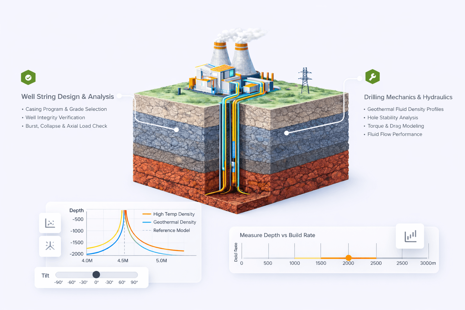
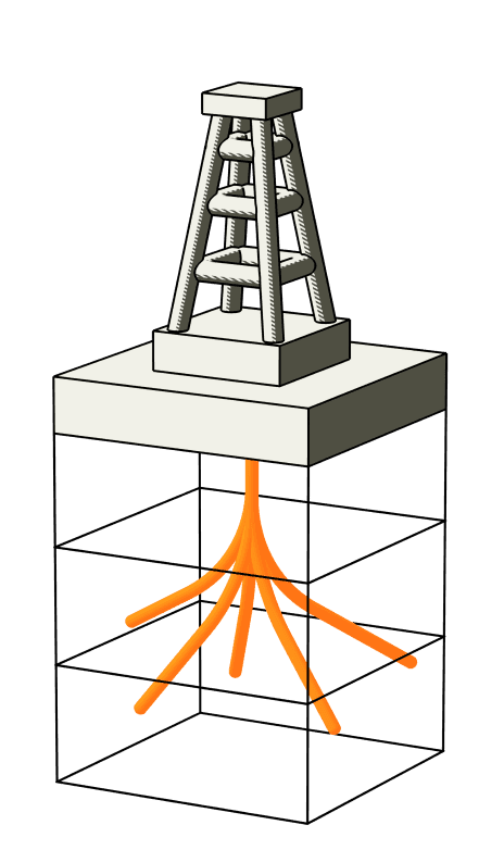
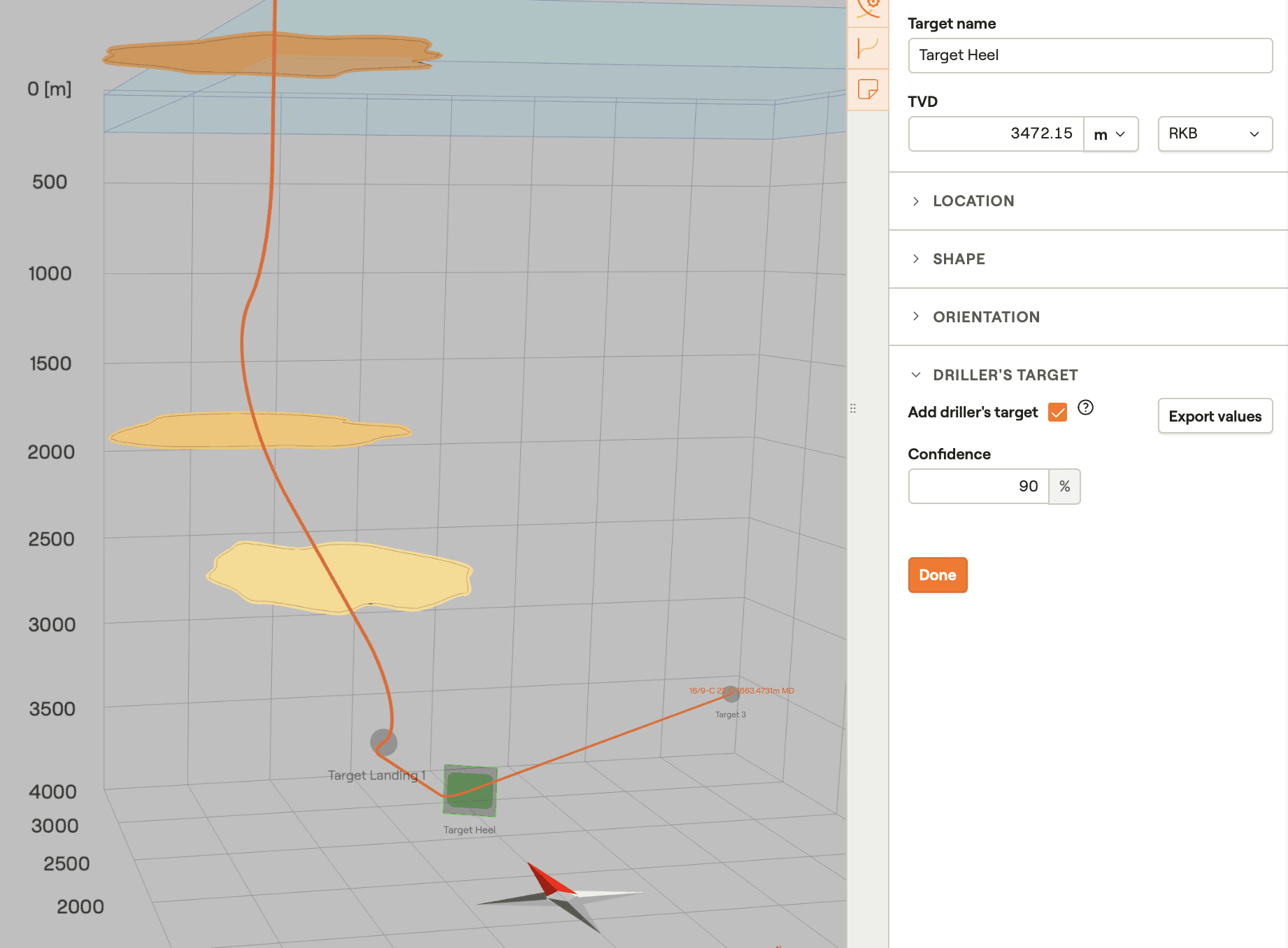
Define subsurface geological targets in a variety of shapes and orientations as well as the formation layers you will be drilling through.

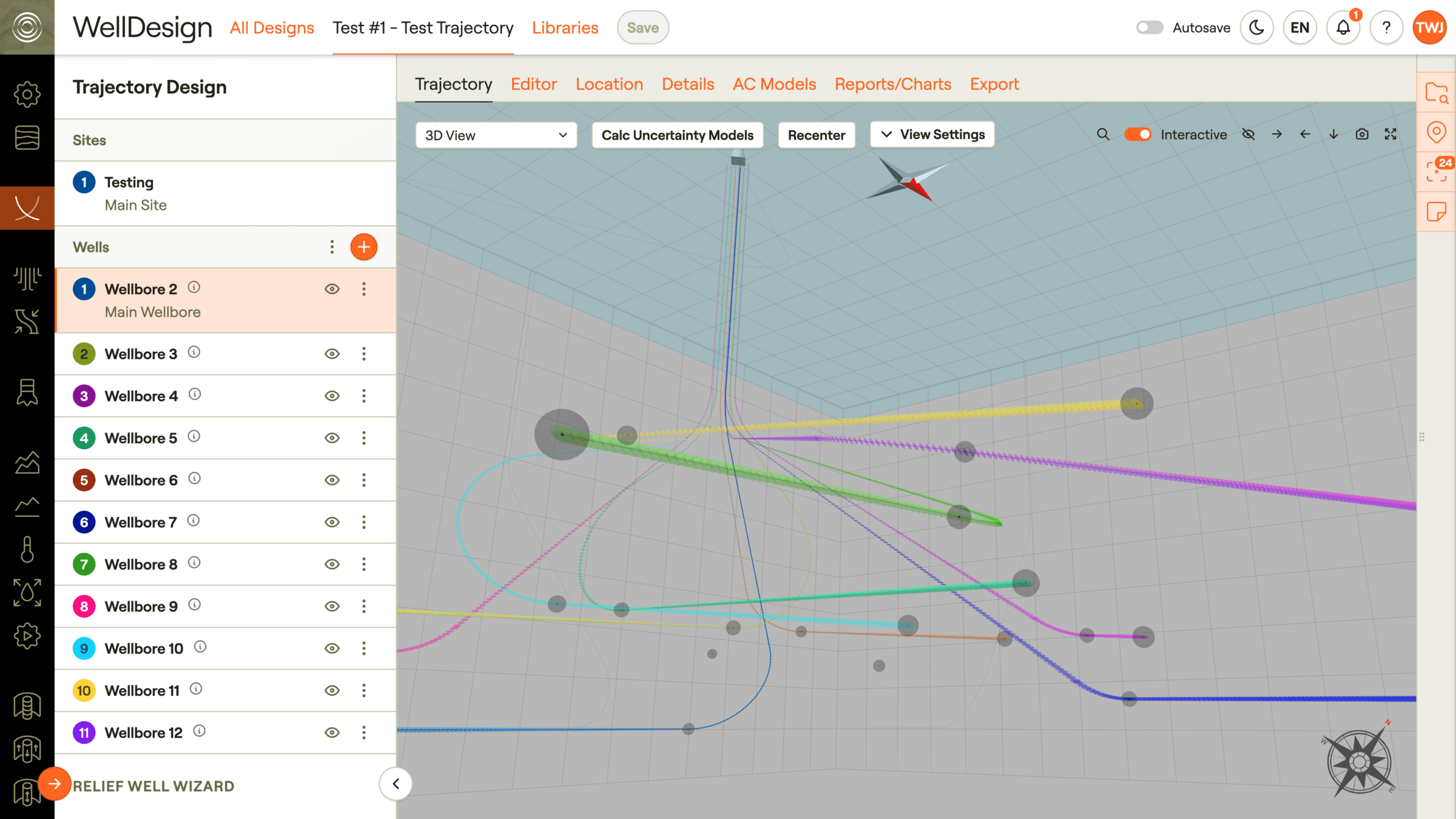
Choose from among a wide variety of parametric build options for building well trajectories through your defined formation layers and for hitting your defined geologic targets. Manage driller's targets based on planned trajectory and associated uncertainty of the well path.
Visualized in a full interactive Web-GL 3D viewer which allows users to navigate and investigate formations, targets and well paths in 3D as well offering results using industry standard plots like plan view, section view, ladder plot, traveling cylinder and more.
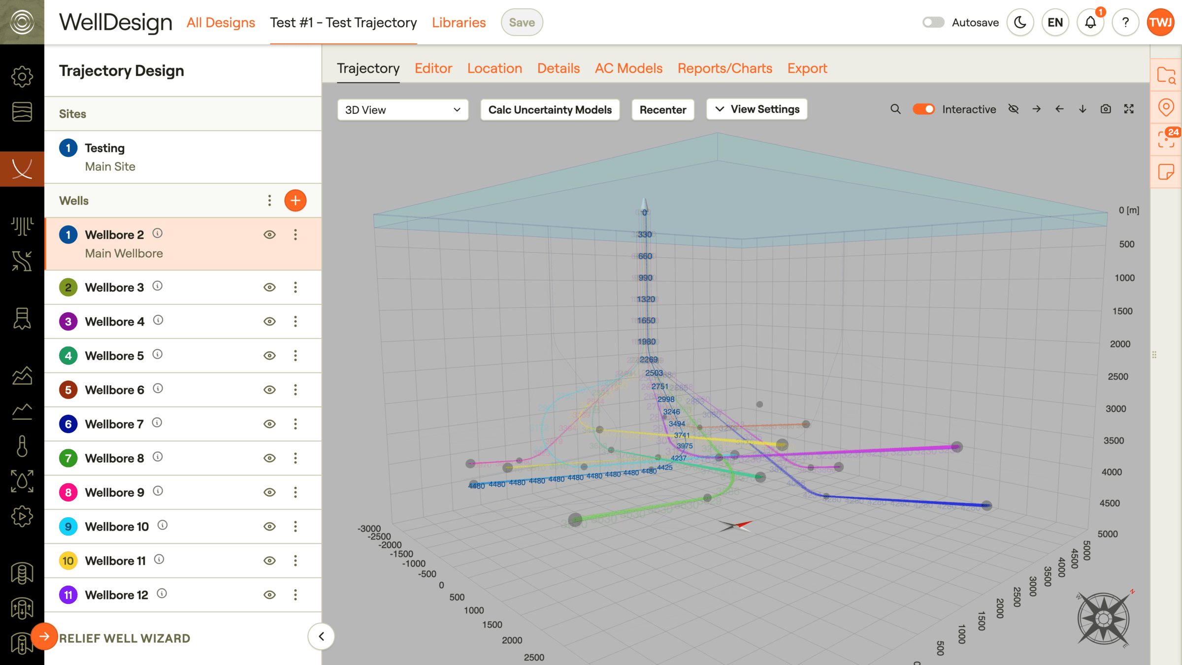
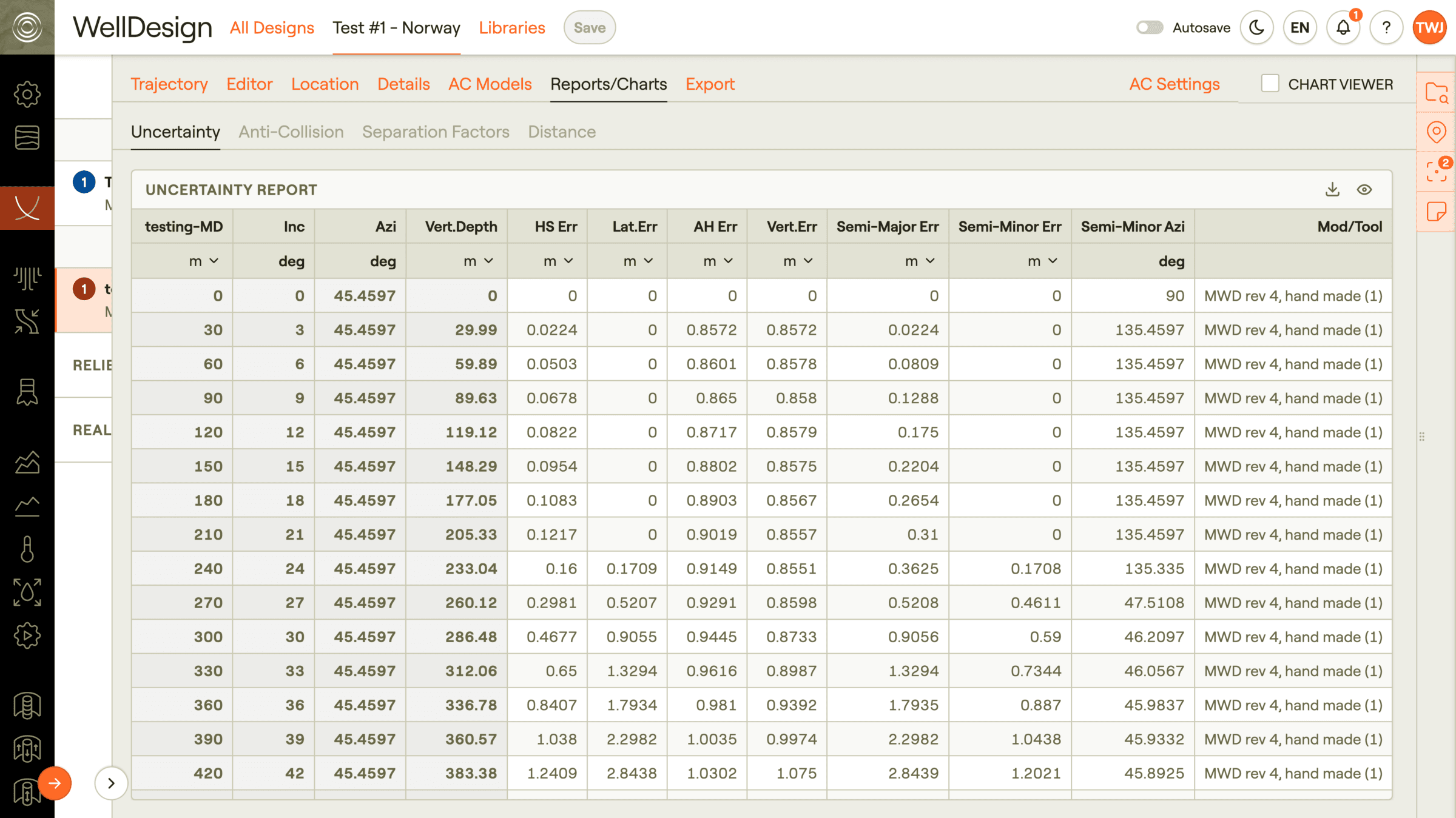
All uncertainty and anti-collision calculations are available at the push of a button against any nearby offset well or site/field. Specify and upload any error tool code such as MWD, stationary and continuous gyro models among others. All uncertainty and anti-collision calculations follow the latest revision standards described by ISCWSA.
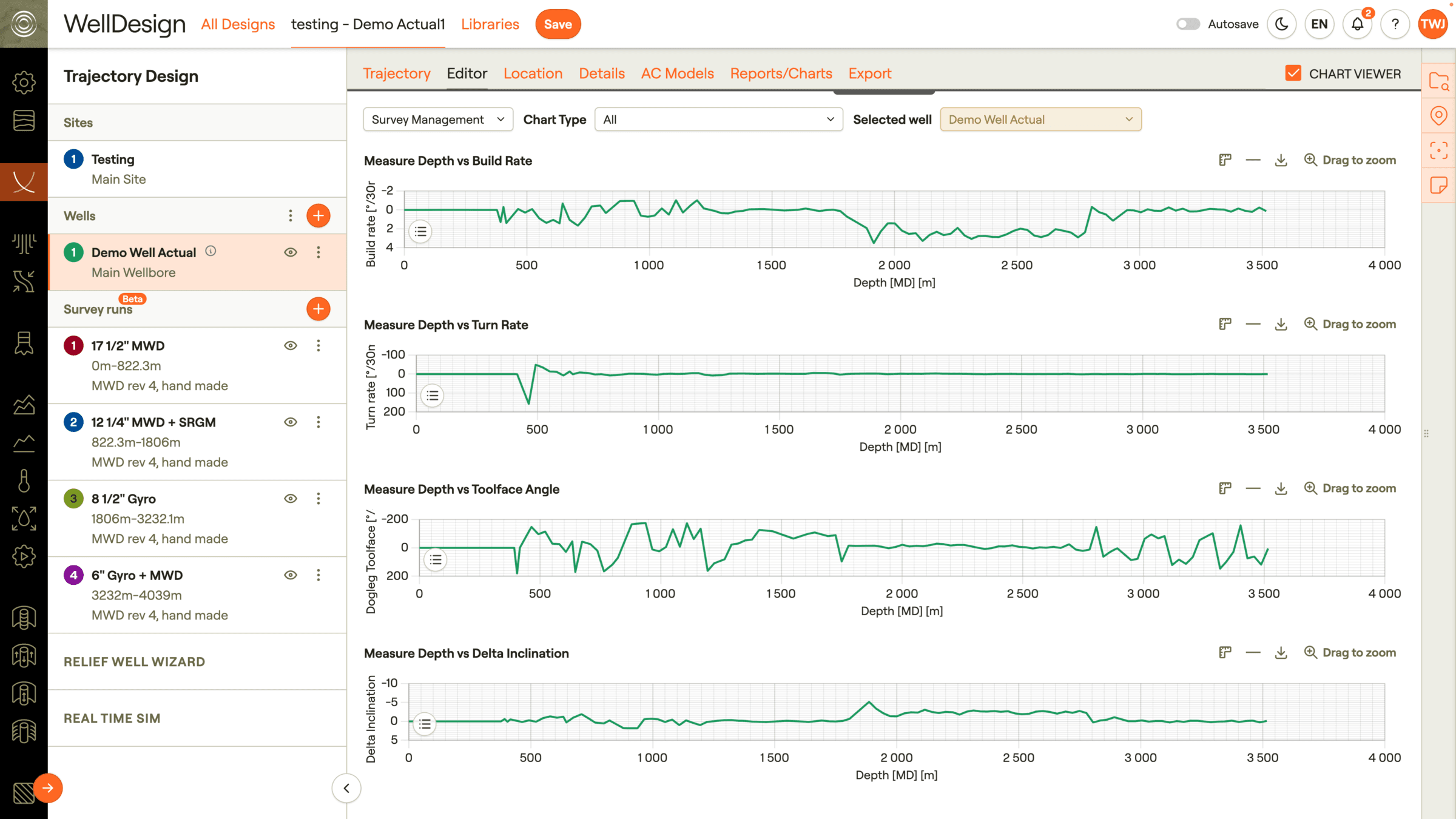
Survey management capabilities for registering survey runs, defining your survey plans, and storing your definitive surveys. Perform QA/QC on survey data through industry standard survey management plots and easily view your survey data in real-time against your original principal design.
Should you bear off track, project ahead using the planning methods and use the 3D view to easily define an intersection point at which to get back on plan.
Key features